A key finance priority for COP27 is scaling up financing for climate adaptation and resilience. This year, we have seen major heat waves, floods, and severe storms that impacted people, businesses, and economies around the world. It’s clear that everyone can benefit from better understanding climate risks.
Geospatial technology has become increasingly sophisticated in recent years. Advanced satellite imagery and remote sensing methods have enabled detailed analysis of these climate-related physical risks. One such technology is Google Earth Engine.
Over the past
decade, Earth Engine has enabled academics, scientists, and NGOs to
advance climate research,
monitor global forest loss,
protect and restore freshwater ecosystems, and explore other sustainability goals. This year, we made Earth Engine
available to businesses and governments worldwide in Google Cloud to help these organizations solve their sustainability challenges.
This integration unlocks some powerful geospatial analytical techniques. For example, while Earth Engine enables advanced “raster” (imagery) analysis, Google BigQuery excels at “vector” (points, polygons) operations on relational data. Put them together and you can query
satellite imagery with SQL.We’re starting to see new sustainability offerings using these approaches. In June, we
introduced two offerings with
Climate Engine and
CARTO to help public sector organizations better understand climate risks and increase their resilience with geospatial technology. And in July, we launched a
portfolio climate risk analytics design pattern with
RS Metrics and
Infosys that demonstrates how financial services institutions can use cloud tools to identify, analyze, report, and monitor climate risks associated with physical hazards in their lending and investment portfolios.

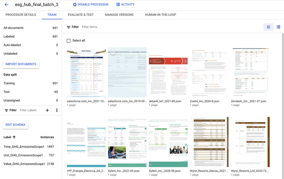 Training a Custom Document Extractor (CDE) model for ESG entity extraction from sustainability reports using Google Document AI.
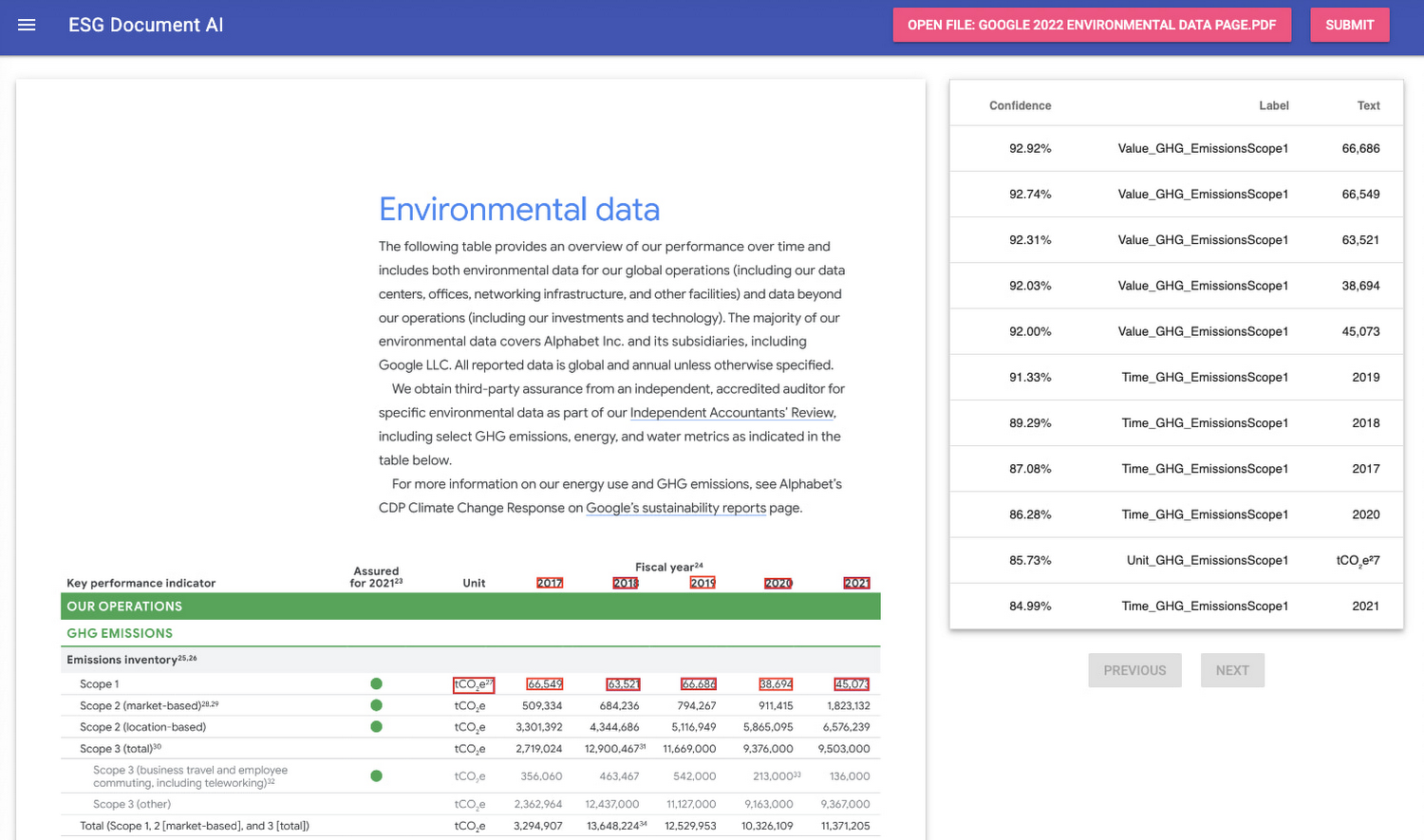 Demo application that uses a CDE model to extract Scope 1 greenhouse gas emissions metrics from a sustainability report.
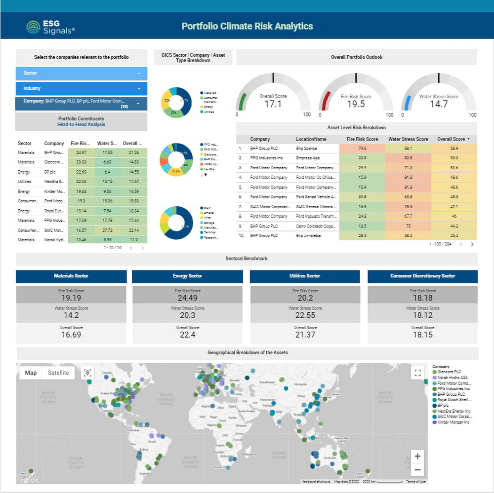 This portfolio climate risk analytics dashboard visualizes sample climate risk data stored in BigQuery using Looker Studio (formerly Data Studio), and dynamically displays aggregate fire and water stress risk scores based on your selections and filters.